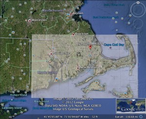
When it comes to technology I am not the greatest. But when it comes to directions, map reading, and anything geographical, I am absolutely not the greatest. Given these weaknesses, I approached the map overlay assignment with a less than optimistic attitude. Though I am not map lover, I am a lover of my hometown: Plymouth, Massachusetts. After googling and googling until I found a map that I liked, I ended up choosing a 1700’s “Harbor Map” painted by Jonathan Welch Edes. The link to that image and its website can be found here.
Adjusting the image to fit was a bit difficult. Overall, the hook of Massachusetts and the general geographical make up looks identical. However, the awkwardly unusual size comparisons between the maps made it difficult to match them up perfectly. But after pulls, stretches, and alterations, I came up with my best overlay:
After this exercise, it’s safe to say that my map matching abilities are not the greatest, but they are certainly better now than they were yesterday.

